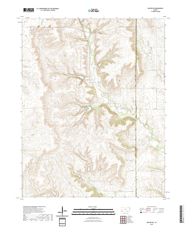
2022 Map of Dexter NE
USGS Topo · Published 2022About this map
The border between Cowley Co Chautauqua Co defines the eastern edge of this landscape, where the prairie begins to break into the complex drainage systems of the Flint Hills region. The terrain is marked by prominent elevations like Hogback Hill, which overlooks a dense network of winding creek beds. Waterways such as Jim Cr, Plum Cr, and Shafer Cr carve deep, meandering paths through the limestone-underlaid hills, creating a rugged topography that has historically dictated the placement of rural ranch roads. The road network, including Kansas RD and Nation RD, follows the section lines where possible but often yields to the natural contours of the land. This map captures the modern distribution of these isolated ranching corridors and the persistent natural drainage patterns, like Otter Creek and Crabb Cr, that have shaped land use in this corner of Kansas for generations.
Find a feature on this map
32 named features on this map. Tap any name to fly to it.
Don’t see what you’re looking for? This feature index may not catch every label — zoom into the map to look around manually.
Map Details
Editions of this 2022 Dexter NE Map
This is the sole edition of this map. No revisions or reprints were ever made.
Other maps of this area

1885 · Sedan
USGS Topo · 1:125,000

1889 · Burden
USGS Topo · 1:125,000

1889 · Sedan
USGS Topo · 1:125,000

1955 · Wichita
USGS Topo · 1:250,000

1958 · Wichita
USGS Topo · 1:250,000
1962 · Cedar Vale West
USGS Topo · 1:24,000

1962 · Dexter SW
USGS Topo · 1:24,000

1962 · Grand Summit
USGS Topo · 1:24,000

1962 · Dexter
USGS Topo · 1:24,000
1962 · Cedar Vale East
USGS Topo · 1:24,000