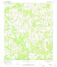
1970 Map of Dexter
USGS Topo · Published 1972About this map
The Dexter Oil and Gas Field dominates the landscape of this region during the early 1970s, where extractive industry and rural community life intersect. Numerous oil wells, gas wells, and a central Compressor Station dot the countryside, reflecting the area's economic focus. This activity is situated alongside long-standing local landmarks such as Lower Temple Ch and Mt Olive Ch, while the settlement of Dexter serves as a local hub near the Walthall and Marion County line.
Find a feature on this map
23 named features on this map. Tap any name to fly to it.
Don’t see what you’re looking for? This feature index may not catch every label — zoom into the map to look around manually.
Map Details
Editions of this 1970 Dexter Map
This is the sole edition of this map. No revisions or reprints were ever made.
Other maps of this area

1942 · Thomas
USGS Topo · 1:31,680

1949 · Angie
USGS Topo · 1:31,680

1950 · Crains Creek
USGS Topo · 1:31,680

1953 · Hattiesburg
USGS Topo · 1:250,000

1953 · Natchez
USGS Topo · 1:250,000

1953 · Mobile
USGS Topo · 1:250,000

1954 · Baton Rouge
USGS Topo · 1:250,000

1956 · Natchez
USGS Topo · 1:250,000

1956 · Baton Rouge
USGS Topo · 1:250,000

1957 · Mobile
USGS Topo · 1:250,000