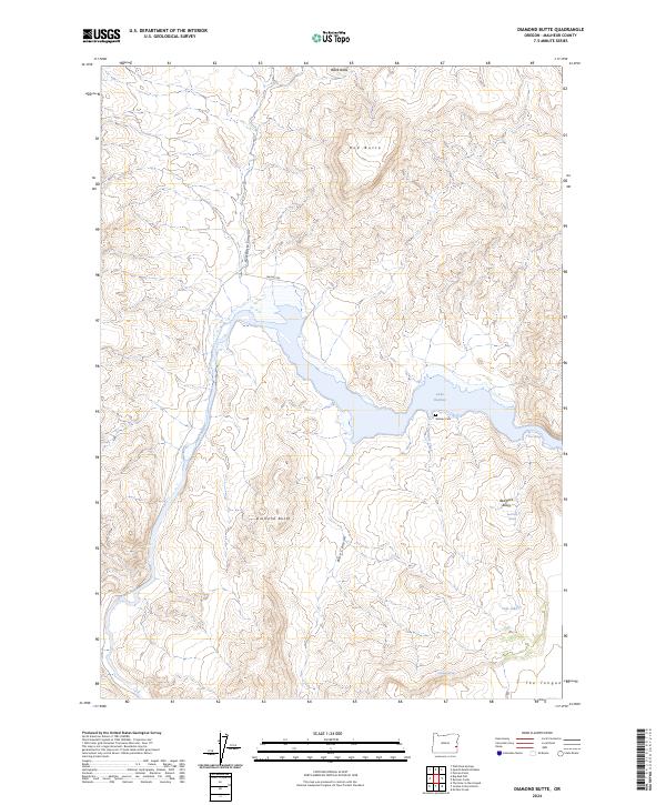
2024 Map of Diamond Butte
USGS Topo · Published 2024About this map
The Owyhee Wild and Scenic River carves a deep path through this southeastern Oregon landscape, where the canyon floor gives way to the broad waters of Lake Owyhee. The geography is defined by prominent volcanic features including Diamond Butte, Red Butte, and Black Butte, which rise above the surrounding basin. This area represents a remote portion of Malheur County where water sources are critical landmarks, evidenced by the presence of Juniper Creek, Tule Lake, and thermal features like Hot Spring.
Find a feature on this map
23 named features on this map. Tap any name to fly to it.
Don’t see what you’re looking for? This feature index may not catch every label — zoom into the map to look around manually.
Map Details
Editions of this 2024 Diamond Butte Map
This is the sole edition of this map. No revisions or reprints were ever made.
Other maps of this area

1955 · Boise
USGS Topo · 1:250,000

1958 · Boise
USGS Topo · 1:250,000

1962 · Boise
USGS Topo · 1:250,000

1967 · Pelican Point
USGS Topo · 1:24,000

1967 · Diamond Butte
USGS Topo · 1:24,000

1967 · Rooster Comb
USGS Topo · 1:24,000

1967 · Quartz Mtn Basin
USGS Topo · 1:24,000

1969 · Mc Cain Creek
USGS Topo · 1:24,000

1969 · Jordan Craters North
USGS Topo · 1:24,000

1972 · Big Mud Flat
USGS Topo · 1:24,000