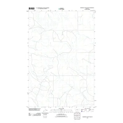
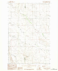
2011 Map of Diamond G Butte NW
USGS Topo · Published 2011About this map
East Fork Bad Route Creek and its many seasonal tributaries carve through this portion of McCone County, creating a complex drainage network typical of the eastern Montana plains. In the early 2010s, this landscape remained largely defined by its topography and a handful of section-line roads, with Union Rd and Road 201 providing the primary access through the territory. The map illustrates a watershed transition where northern drainages like Deep Bottom and Dry Ash Creek give way to the southerly flow of South Fork Tusler Creek. This survey provides a precise look at the land's contours before further modernization, documenting the exact positions of minor waterways such as North Fork Tusler Creek and South Fork Clear Creek.
Find a feature on this map
9 named features on this map. Tap any name to fly to it.
Don’t see what you’re looking for? This feature index may not catch every label — zoom into the map to look around manually.
Map Details
Editions of this 2011 Diamond G Butte NW Map
This is the sole edition of this map. No revisions or reprints were ever made.
Other maps of this area

1954 · Glendive
USGS Topo · 1:250,000

1957 · Glendive
USGS Topo · 1:250,000

1958 · Glendive
USGS Topo · 1:250,000

1982 · Circle
USGS Topo · 1:100,000
1983 · Becker Dam
USGS Topo · 1:24,000
1983 · Union School
USGS Topo · 1:24,000
1983 · North Coulee
USGS Topo · 1:24,000

1983 · Olson Coulee South
USGS Topo · 1:24,000

1983 · Mount Antelope
USGS Topo · 1:24,000
1983 · Diamond G Butte
USGS Topo · 1:24,000