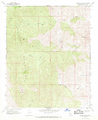
1967 Map of Diamond Joe Peak
USGS Topo · Published 1969About this map
The high peaks of the Hualapai Mountains dominate this Mohave County landscape, rising to prominent summits like Pine Peak, Burch Peak, and the namesake Diamond Joe Peak. This 1967 field-checked survey reveals an era of specialized activity in the high desert, centered on isolated mining operations and water sources. The Leviathan Mine and several scattered prospects indicate the mineral interest in the area, while the presence of Ruins near Cedar Canyon suggests older habitations or outposts along these arid corridors.
Find a feature on this map
23 named features on this map. Tap any name to fly to it.
Don’t see what you’re looking for? This feature index may not catch every label — zoom into the map to look around manually.
Map Details
Editions of this 1967 Diamond Joe Peak Map
2 editions found
Other maps of this area

1923 · Signal
USGS Topo · 1:250,000

1942 · Signal
USGS Topo · 1:250,000

1950 · Prescott
USGS Topo · 1:250,000

1954 · Prescott
USGS Topo · 1:250,000

1958 · Prescott
USGS Topo · 1:250,000

1959 · Prescott
USGS Topo · 1:250,000

1960 · Prescott
USGS Topo · 1:250,000

1965 · Prescott
USGS Topo · 1:250,000
1967 · Gunsight Canyon
USGS Topo · 1:24,000
1967 · Beecher Canyon
USGS Topo · 1:24,000