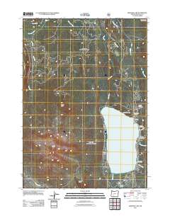
2011 Map of Diamond Lake
USGS Topo · Published 2011About this map
Diamond Lake sits at the center of this high-elevation landscape within the Oregon Cascades Recreation Area, serving as a primary hub for recreation and seasonal residence in Douglas County. The shoreline is punctuated by facilities such as the Diamond Lake Post Office and the North End Boat Ramp, along with numerous established sites like White Fir Forest Camp and Pumice Beach. To the west, the massive profile of Mount Bailey dominates the terrain, while volcanic features like Rodley Butte and Hemlock Butte define the surrounding forest topography.
Find a feature on this map
26 named features on this map. Tap any name to fly to it.
Don’t see what you’re looking for? This feature index may not catch every label — zoom into the map to look around manually.
Map Details
Editions of this 2011 Diamond Lake Map
This is the sole edition of this map. No revisions or reprints were ever made.
Other maps of this area

1917 · Diamond Lake
USGS Topo · 1:125,000

1956 · Toketee Falls
USGS Topo · 1:62,500

1956 · Diamond Lake
USGS Topo · 1:62,500

1956 · Summit Lake
USGS Topo · 1:62,500

1956 · Garwood Butte
USGS Topo · 1:62,500

1958 · Roseburg
USGS Topo · 1:250,000

1959 · Roseburg
USGS Topo · 1:250,000

1978 · Diamond Lake
USGS Topo · 1:100,000
1985 · Pumice Desert East
USGS Topo · 1:24,000
1985 · Garwood Butte
USGS Topo · 1:24,000