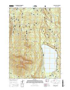
2017 Map of Diamond Lake
USGS Topo · Published 2017About this map
Diamond Lake sits at the center of this high-elevation landscape within the Umpqua National Forest, where volcanic geology defines every landform. To the west, the massive profile of Mt Bailey dominates the horizon, its eastern slopes descending toward Pumice Beach on the lakeshore. The area's complex hydrology is evident in the numerous drainages that feed and drain the basin, including the headwaters of the Clearwater River and Lake Cr.
Find a feature on this map
37 named features on this map. Tap any name to fly to it.
Don’t see what you’re looking for? This feature index may not catch every label — zoom into the map to look around manually.
Map Details
Editions of this 2017 Diamond Lake Map
This is the sole edition of this map. No revisions or reprints were ever made.
Other maps of this area

1917 · Diamond Lake
USGS Topo · 1:125,000

1956 · Toketee Falls
USGS Topo · 1:62,500

1956 · Diamond Lake
USGS Topo · 1:62,500

1956 · Summit Lake
USGS Topo · 1:62,500

1956 · Garwood Butte
USGS Topo · 1:62,500

1958 · Roseburg
USGS Topo · 1:250,000

1959 · Roseburg
USGS Topo · 1:250,000

1978 · Diamond Lake
USGS Topo · 1:100,000
1985 · Pumice Desert East
USGS Topo · 1:24,000
1985 · Garwood Butte
USGS Topo · 1:24,000