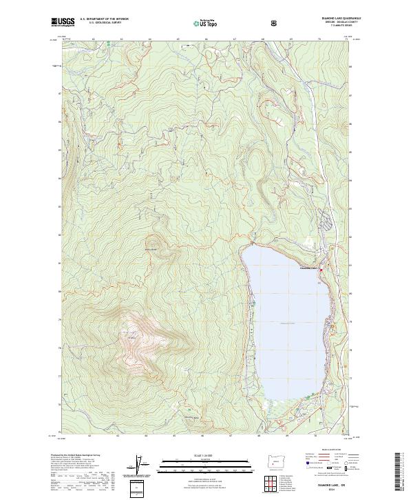
2024 Map of Diamond Lake
USGS Topo · Published 2024About this map
Diamond Lake serves as the focal point of this recreational landscape, where the waters of the Clearwater River and Lava Creek define the hydrologic character of the high Cascades. The map documents a complex network of winter and summer transit, including the Mt Bailey Trl and the Dellenback Bike Path Trl, illustrating the area's development for outdoor activity. Prominent volcanic features like Mt Bailey, Rodley Butte, and Hemlock Butte tower over the basin, providing the dramatic topography that feeds tributaries such as Silent Creek and Lake Creek. The concentration of cross-country ski and snowmobile trails, such as the Cinnamon Butte Xc-Ski Trl and Bear Creek Snomo Trl, indicates a landscape primarily managed for seasonal forest access and preservation within the Douglas County wilderness.
Find a feature on this map
54 named features on this map. Tap any name to fly to it.
Don’t see what you’re looking for? This feature index may not catch every label — zoom into the map to look around manually.
Map Details
Editions of this 2024 Diamond Lake Map
This is the sole edition of this map. No revisions or reprints were ever made.
Other maps of this area

1917 · Diamond Lake
USGS Topo · 1:125,000

1956 · Toketee Falls
USGS Topo · 1:62,500

1956 · Diamond Lake
USGS Topo · 1:62,500

1956 · Summit Lake
USGS Topo · 1:62,500

1956 · Garwood Butte
USGS Topo · 1:62,500

1958 · Roseburg
USGS Topo · 1:250,000

1959 · Roseburg
USGS Topo · 1:250,000

1978 · Diamond Lake
USGS Topo · 1:100,000
1985 · Pumice Desert East
USGS Topo · 1:24,000
1985 · Garwood Butte
USGS Topo · 1:24,000