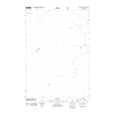
2011 Map of Diamond Peak
USGS Topo · Published 2011About this map
Diamond Peak dominates the landscape of this high-elevation terrain in Butte County, where deep drainages and canyon systems define the local geography. The area's complex topography is etched by the Right Fork Rocky Canyon and Left Fork Rocky Canyon in the west, while the eastern slope is marked by the steep walls of Bighorn Canyon. These landforms indicate a wilderness character, where movement is dictated by the natural corridors of the canyon floors and the ridgelines that separate them.
Find a feature on this map
12 named features on this map. Tap any name to fly to it.
Don’t see what you’re looking for? This feature index may not catch every label — zoom into the map to look around manually.
Map Details
Editions of this 2011 Diamond Peak Map
This is the sole edition of this map. No revisions or reprints were ever made.
Other maps of this area

1955 · Dubois
USGS Topo · 1:250,000

1956 · Nicholia
USGS Topo · 1:62,500

1957 · Diamond Peak
USGS Topo · 1:62,500

1957 · Scott Peak
USGS Topo · 1:62,500

1958 · Dubois
USGS Topo · 1:250,000

1969 · Eightmile Canyon
USGS Topo · 1:24,000
1969 · Blue Dome
USGS Topo · 1:24,000

1983 · Dubois
USGS Topo · 1:100,000
1987 · Fallert Springs
USGS Topo · 1:24,000
1987 · Nicholia
USGS Topo · 1:24,000