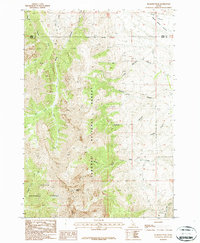
1987 Map of Diamond Peak
USGS Topo · Published 1987About this map
Diamond Peak dominates the center of this high-elevation landscape, where the Targhee National Forest and Challis National Forest meet along the border of Butte and Lemhi Counties. The terrain is defined by a series of deep drainage systems that flow away from the central heights, including the intricate network of Sawmill Canyon, Little Sawmill Canyon, and Bighorn Canyon to the east. To the south, the headwaters of Pass Creek and its various forks, such as North Fork Pass Creek, illustrate the complex hydrology of the Lemhi Range. Historically, this area supported high-country exploration and resource extraction, evidenced by various prospects scattered near the ridges of Sawmill Canyon. The map preserves the exact alignment of established trails and primitive roads as they existed in the 1980s, providing a reference for the routes into the backcountry through Kaufman Gulch and across the Pass.
Find a feature on this map
19 named features on this map. Tap any name to fly to it.
Don’t see what you’re looking for? This feature index may not catch every label — zoom into the map to look around manually.
Map Details
Editions of this 1987 Diamond Peak Map
This is the sole edition of this map. No revisions or reprints were ever made.
Other maps of this area

1955 · Dubois
USGS Topo · 1:250,000

1956 · Nicholia
USGS Topo · 1:62,500

1957 · Diamond Peak
USGS Topo · 1:62,500

1957 · Scott Peak
USGS Topo · 1:62,500

1958 · Dubois
USGS Topo · 1:250,000

1969 · Eightmile Canyon
USGS Topo · 1:24,000
1969 · Blue Dome
USGS Topo · 1:24,000

1983 · Dubois
USGS Topo · 1:100,000
1987 · Fallert Springs
USGS Topo · 1:24,000
1987 · Nicholia
USGS Topo · 1:24,000