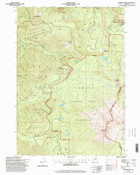
1997 Map of Diamond Peak
USGS Topo · Published 1998About this map
Diamond Peak anchors this high-elevation landscape within the Cascade Range, serving as a focal point for the Diamond Peak Wilderness and surrounding forest lands. This late-twentieth-century survey documents a wilderness area largely defined by its water and volcanic topography, featuring numerous alpine basins such as those containing Vivian Lake, Notch Lake, and Too Much Bear Lake. The terrain is characterized by prominent summits like Mount Yoran and Hemlock Butte, which provide a dramatic backdrop for the headwaters of Salt Creek and Pinto Creek.
Find a feature on this map
43 named features on this map. Tap any name to fly to it.
Don’t see what you’re looking for? This feature index may not catch every label — zoom into the map to look around manually.
Map Details
Editions of this 1997 Diamond Peak Map
This is the sole edition of this map. No revisions or reprints were ever made.
Other maps of this area

1917 · Diamond Lake
USGS Topo · 1:125,000

1925 · Waldo Lake
USGS Topo · 1:125,000

1956 · Toketee Falls
USGS Topo · 1:62,500

1956 · Waldo Lake
USGS Topo · 1:62,500

1956 · Summit Lake
USGS Topo · 1:62,500

1956 · Oakridge
USGS Topo · 1:62,500

1958 · Roseburg
USGS Topo · 1:250,000

1959 · Roseburg
USGS Topo · 1:250,000

1978 · Diamond Lake
USGS Topo · 1:100,000

1983 · Oakridge
USGS Topo · 1:100,000