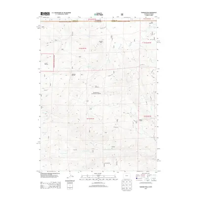
2013 Map of Diamond Peak
USGS Topo · Published 2013About this map
Roosevelt National Forest dominates this high-altitude landscape along the border of Colorado and Wyoming. The terrain is defined by prominent peaks including Diamond Peak and Iron Mountain, which separate the various drainages flowing through the region. In the south, the North Fork Cache La Poudre River winds through the area near Chicken Park and Log Draw. This 2013 survey illustrates a transition from the undeveloped wilderness of the national forest to a network of remote access routes such as Co Road 65E and Mill Creek Rd. Water sources like Kelsey Lake and Mill Creek Spring serve as critical landmarks for navigators in this mountainous environment, while steep features like Devils Canyon and Devils Gulch indicate the complex topography of the Front Range.
Find a feature on this map
39 named features on this map. Tap any name to fly to it.
Don’t see what you’re looking for? This feature index may not catch every label — zoom into the map to look around manually.
Map Details
Editions of this 2013 Diamond Peak Map
This is the sole edition of this map. No revisions or reprints were ever made.
Other maps of this area

1895 · Laramie
USGS Topo · 1:125,000

1902 · Laramie
USGS Topo · 1:125,000

1905 · Sherman
USGS Topo · 1:125,000

1905 · Laramie
USGS Topo · 1:125,000

1906 · Laramie
USGS Topo · 1:125,000

1907 · Livermore
USGS Topo · 1:125,000

1908 · Laramie
USGS Topo · 1:125,000

1909 · Livermore
USGS Topo · 1:125,000

1916 · Home
USGS Topo · 1:125,000

1920 · Home
USGS Topo · 1:125,000