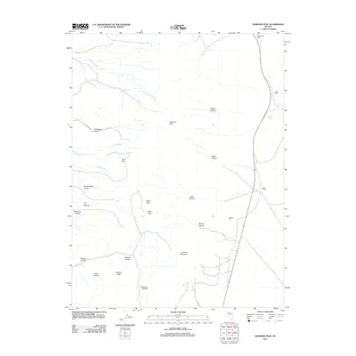
2012 Map of Diamond Peak
USGS Topo · Published 2012About this map
Newark Mill stands as a primary industrial landmark in this high-elevation corridor of White Pine County, where mining and ranching have long defined the local economy. The landscape is dominated by the massive presence of Diamond Peak and several surrounding summits, including Alpha Peak, Newark Mountain, and Fusulina Peak. These peaks are intersected by deep drainage systems like Water Canyon and Mining Canyon, which suggest a history of resource extraction and water management in a semi-arid environment. Along the eastern valley floor, a string of established agricultural outposts like De Bernardi Ranch, Circle Ranch, and Stinson Ranch follow the road network, while the path of the Old Arden Ranch road traces older transit routes through the canyons. This map documents a region where modern ranching operations and legacy industrial sites like Newark Mill coexist within a complex system of named ridges, flats, and springs.
Find a feature on this map
32 named features on this map. Tap any name to fly to it.
Don’t see what you’re looking for? This feature index may not catch every label — zoom into the map to look around manually.
Map Details
Editions of this 2012 Diamond Peak Map
This is the sole edition of this map. No revisions or reprints were ever made.
Other maps of this area

1951 · Pancake Summit
USGS Topo · 1:62,500

1953 · Pinto Summit
USGS Topo · 1:62,500

1953 · Eureka
USGS Topo · 1:62,500

1956 · Ely
USGS Topo · 1:250,000

1957 · Buck Mountain
USGS Topo · 1:62,500

1959 · Ely
USGS Topo · 1:250,000

1963 · Ely
USGS Topo · 1:250,000

1979 · Mt. Hamilton
USGS Topo · 1:100,000

1985 · Newark Lake
USGS Topo · 1:100,000
1990 · Pinto Summit
USGS Topo · 1:24,000