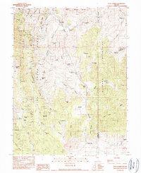
1990 Map of Pinto Summit
USGS Topo · Published 1990About this map
The high-desert terrain of Eureka County and White Pine County reveals an intensive history of resource extraction near the close of the twentieth century. The Fish Creek Range and Diamond Mountains dominate the landscape, harboring legacy operations like the Windfall Mine, Hoosac Mine, and Mineral Hill Mines. These sites, along with subterranean features such as the Diamond Tunnel and Eureka Shaft, mark a rugged district where industrial pursuits shaped the topography long after the initial booms of the region.
Find a feature on this map
67 named features on this map. Tap any name to fly to it.
Don’t see what you’re looking for? This feature index may not catch every label — zoom into the map to look around manually.
Map Details
Editions of this 1990 Pinto Summit Map
This is the sole edition of this map. No revisions or reprints were ever made.
Other maps of this area

1926 · Roberts Mountains
USGS Topo · 1:250,000

1929 · Roberts Mountains
USGS Topo · 1:250,000

1953 · Pinto Summit
USGS Topo · 1:62,500

1953 · Eureka
USGS Topo · 1:62,500

1955 · Millett
USGS Topo · 1:250,000

1956 · Bellevue Peak
USGS Topo · 1:62,500

1956 · Whistler Mtn
USGS Topo · 1:62,500

1956 · Ely
USGS Topo · 1:250,000

1959 · Ely
USGS Topo · 1:250,000

1959 · Millett
USGS Topo · 1:250,000