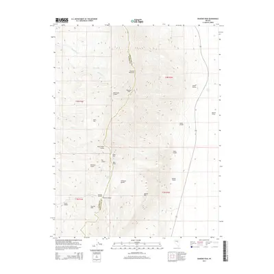
2014 Map of Diamond Peak
USGS Topo · Published 2014About this map
The Diamond Mountains dominate this high-elevation landscape along the border of Eureka and White Pine Counties. At the center of the range stands Diamond Peak, a prominent landmark surrounded by a network of steep drainages including Hildebrand Canyon and Moritz Nager Canyon. The topography reveals a history of movement through these highlands, evidenced by Newark Summit and the aptly named Tollhouse Canyon, which suggests an era of controlled mountain transit.
Find a feature on this map
32 named features on this map. Tap any name to fly to it.
Don’t see what you’re looking for? This feature index may not catch every label — zoom into the map to look around manually.
Map Details
Editions of this 2014 Diamond Peak Map
This is the sole edition of this map. No revisions or reprints were ever made.
Other maps of this area

1951 · Pancake Summit
USGS Topo · 1:62,500

1953 · Pinto Summit
USGS Topo · 1:62,500

1953 · Eureka
USGS Topo · 1:62,500

1956 · Ely
USGS Topo · 1:250,000

1957 · Buck Mountain
USGS Topo · 1:62,500

1959 · Ely
USGS Topo · 1:250,000

1963 · Ely
USGS Topo · 1:250,000

1979 · Mt. Hamilton
USGS Topo · 1:100,000

1985 · Newark Lake
USGS Topo · 1:100,000
1990 · Pinto Summit
USGS Topo · 1:24,000