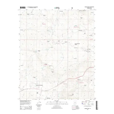
2014 Map of Diamond Point
USGS Topo · Published 2014About this map
The Mogollon Rim dominates the northern horizon of this landscape, where the high plateau drops away into a complex network of canyons and draws within the Tonto National Forest. Settlement is concentrated in the southern half of the quadrangle along State Hwy 260, where Star Valley and the residential area of Diamond Point Shadows have established a foothold. Further east, the highway winds through Preacher Canyon toward the distinct community of Tonto Village. The map reveals a land defined by water management and topography, from the drainage of Green Valley Cr to numerous named cattle tanks like Jackass Tank and Box Trap Tank. This 2014 survey documents the modern interface between remote forest land and growing rural mountain communities, preserving the location of family-named landmarks such as Mead Ranch and Roberts Mesa.
Find a feature on this map
61 named features on this map. Tap any name to fly to it.
Don’t see what you’re looking for? This feature index may not catch every label — zoom into the map to look around manually.
Map Details
Editions of this 2014 Diamond Point Map
This is the sole edition of this map. No revisions or reprints were ever made.
Other maps of this area

1887 · Verde
USGS Topo · 1:250,000

1892 · Verde
USGS Topo · 1:250,000

1934 · Pine
USGS Topo · 1:62,500

1934 · Promontory Butte
USGS Topo · 1:62,500

1936 · Payson
USGS Topo · 1:48,000

1937 · Diamond Butte
USGS Topo · 1:48,000

1939 · Promontory Butte
USGS Topo · 1:62,500

1940 · Pine
USGS Topo · 1:62,500

1942 · Payson
USGS Topo · 1:62,500

1943 · Diamond Butte
USGS Topo · 1:62,500
Featured Places
- Star Valley, AZ
- Little Green Valley, AZ
- La Cienega, AZ
- Diamond Point Summer Homes, AZ
- Ellison Creek Estates, AZ