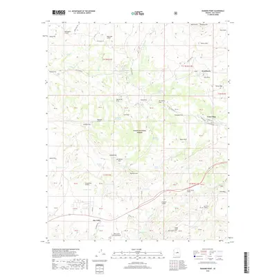
2018 Map of Diamond Point
USGS Topo · Published 2018About this map
Star Valley sits at the southern edge of this Arizona landscape, where the high country begins its dramatic ascent. The map is defined by the massive geological transitions of the Mogollon Rim and Diamond Rim, which create a complex network of drainages and canyons. The Tonto National Forest covers much of the area, punctuated by small residential clusters like Tonto Village and Mead Ranch. This survey captures the land's character through its numerous springs and livestock tanks, such as Mayfield Spring and Box Trap Tank, which were essential for survival and ranching in these high-elevation valleys. The presence of Schoolhouse Canyon and Little Green Valley suggests the enduring footprints of early settlers who navigated the steep terrain between the Myrtle Point overlook and the depths of Hells Gate Canyon.
Find a feature on this map
84 named features on this map. Tap any name to fly to it.
Don’t see what you’re looking for? This feature index may not catch every label — zoom into the map to look around manually.
Map Details
Editions of this 2018 Diamond Point Map
This is the sole edition of this map. No revisions or reprints were ever made.
Other maps of this area

1887 · Verde
USGS Topo · 1:250,000

1892 · Verde
USGS Topo · 1:250,000

1934 · Pine
USGS Topo · 1:62,500

1934 · Promontory Butte
USGS Topo · 1:62,500

1936 · Payson
USGS Topo · 1:48,000

1937 · Diamond Butte
USGS Topo · 1:48,000

1939 · Promontory Butte
USGS Topo · 1:62,500

1940 · Pine
USGS Topo · 1:62,500

1942 · Payson
USGS Topo · 1:62,500

1943 · Diamond Butte
USGS Topo · 1:62,500
Featured Places
- Star Valley, AZ
- Little Green Valley, AZ
- La Cienega, AZ
- Diamond Point Summer Homes, AZ
- Ellison Creek Estates, AZ