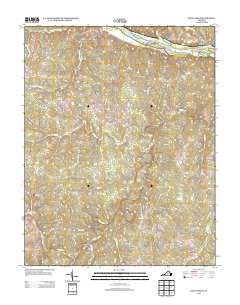
2013 Map of Diana Mills
USGS Topo · Published 2013About this map
Diana Mills and Sunny Side anchor this part of Buckingham County, where the landscape is defined by the winding course of the Slate River and its numerous tributaries. The terrain transitions from the alluvial bottomlands of the James River in the north to the upland ridges that separate small rural communities. The presence of Seven Islands and Gregory Island within the river channel highlights the historical importance of the James as both a navigational hurdle and a geographical boundary. Moving inland, naming patterns like Paynes Mill and Taggart suggest a history centered on local milling and small-scale commerce along historical routes like Bridgeport Rd. Researchers will find a network of secondary roads connecting established locales such as Well Water and Slate Hill, illustrating the enduring settlement patterns of central Virginia's Piedmont region.
Find a feature on this map
64 named features on this map. Tap any name to fly to it.
Don’t see what you’re looking for? This feature index may not catch every label — zoom into the map to look around manually.
Map Details
Editions of this 2013 Diana Mills Map
This is the sole edition of this map. No revisions or reprints were ever made.
Other maps of this area

1891 · Palmyra
USGS Topo · 1:125,000

1892 · Buckingham
USGS Topo · 1:125,000

1895 · Palmyra
USGS Topo · 1:125,000

1897 · Palmyra
USGS Topo · 1:125,000

1929 · Covesville
USGS Topo · 1:62,500

1935 · Covesville
USGS Topo · 1:62,500

1943 · Scottsville
USGS Topo · 1:62,500

1945 · Covesville
USGS Topo · 1:62,500

1946 · Scottsville
USGS Topo · 1:62,500

1947 · Roanoke
USGS Topo · 1:250,000