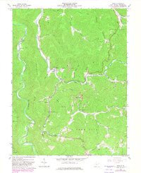
1967 Map of Diana
USGS Topo · Published 1982About this map
The Right Fork Holly River carves a deep valley through this portion of Webster County, defining the local geography around the settlement of Diana. This landscape is characterized by a dense network of hollows and ridges, such as Hodam Mountain and Cool Spring Knob, where small communities and family landmarks are concentrated along the narrow stream bottoms. A strong sense of rural community is evident through numerous small houses of worship, including Bethany Ch, Holly River Ch, and Mt Zion Ch near Orndorff. Economic activity is represented by scattered industrial marks like a Strip Mine and other Mine locations. Genealogists will find particular value in the documentation of family-named burial grounds like Clifton Cem and Cuttip Cem, situated near smaller drainage features like Shop Run and Ezra Run.
Find a feature on this map
65 named features on this map. Tap any name to fly to it.
Don’t see what you’re looking for? This feature index may not catch every label — zoom into the map to look around manually.
Map Details
Editions of this 1967 Diana Map
3 editions found
Other maps of this area

1889 · Nicholas
USGS Topo · 1:125,000

1891 · Nicholas
USGS Topo · 1:125,000

1891 · Huntersville
USGS Topo · 1:125,000

1893 · Buckhannon
USGS Topo · 1:125,000

1893 · Sutton
USGS Topo · 1:125,000

1894 · Huntersville
USGS Topo · 1:125,000

1896 · Buckhannon
USGS Topo · 1:125,000

1897 · Buckhannon
USGS Topo · 1:125,000

1901 · Nicholas
USGS Topo · 1:125,000

1908 · Sutton
USGS Topo · 1:48,000