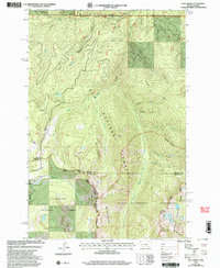
1999 Map of Dick Creek
USGS Topo · Published 2003About this map
The Bitterroot Mountains define the high-altitude landscape of this 1999 revision, where the borders of Idaho and Montana converge. This remote terrain is primarily managed by the Lolo National Forest and Clearwater National Forest, showing a network of drainage systems like Lolo Creek and its many tributaries, including Dick Creek and Johnny Creek. A rare sign of industrial history is found at the Ward Lode Mine, tucked near the Sally Ridge Trail.
Find a feature on this map
32 named features on this map. Tap any name to fly to it.
Don’t see what you’re looking for? This feature index may not catch every label — zoom into the map to look around manually.
Map Details
Editions of this 1999 Dick Creek Map
This is the sole edition of this map. No revisions or reprints were ever made.
Other maps of this area

1912 · Missoula
USGS Topo · 1:125,000

1956 · Hamilton
USGS Topo · 1:250,000

1959 · Hamilton
USGS Topo · 1:250,000

1960 · Hamilton
USGS Topo · 1:250,000

1964 · Hamilton
USGS Topo · 1:250,000

1964 · Garden Point
USGS Topo · 1:24,000

1964 · Dick Creek
USGS Topo · 1:24,000

1964 · West Fork Butte
USGS Topo · 1:24,000
1964 · Blue Mountain
USGS Topo · 1:24,000
1964 · Camp Creek
USGS Topo · 1:24,000