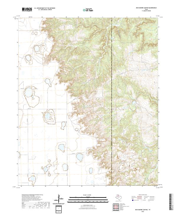
2022 Map of Dick Moore Canyon
USGS Topo · Published 2022About this map
The Floyd Co Motley Co line bisects this Texas Panhandle landscape, where the high plains break into the complex drainage systems of the N Pease River. The northern portion is dominated by the dramatic topography of Dick Moore Canyon, which cuts deeply through the caprock. This area is characterized by seasonal watercourses and springs that have historically dictated land use in this arid region, including Miller Springs and Mott Camp Springs. A network of county roads, such as Co RD 160 and Co RD 303, provides access to the cattle country and canyons. The presence of several named creeks, such as Boggy Creek and Chimney Cr, illustrates the importance of riparian corridors for ranching operations along the boundary of these two counties.
Find a feature on this map
21 named features on this map. Tap any name to fly to it.
Don’t see what you’re looking for? This feature index may not catch every label — zoom into the map to look around manually.
Map Details
Editions of this 2022 Dick Moore Canyon Map
This is the sole edition of this map. No revisions or reprints were ever made.
Other maps of this area

1954 · Lubbock
USGS Topo · 1:250,000

1954 · Plainview
USGS Topo · 1:250,000

1958 · Plainview
USGS Topo · 1:250,000

1965 · Boothe
USGS Topo · 1:24,000

1966 · Lockney 4 SW
USGS Topo · 1:24,000

1967 · Quitaque Peaks
USGS Topo · 1:24,000

1967 · Dick Moore Canyon
USGS Topo · 1:24,000

1967 · Flomot
USGS Topo · 1:24,000
1967 · Wilson Creek
USGS Topo · 1:24,000

1967 · Whiteflat
USGS Topo · 1:24,000