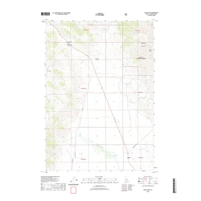
2020 Map of Dickey Peak
USGS Topo · Published 2020About this map
Dickey sits at the intersection of mountain geography and essential water sources in this Custer County corridor. The landscape is defined by the massive rise of the Lost River Range and the Pahsimeroi Mountains, with Dickey Peak serving as a primary landmark. To the northwest, Willow Creek Summit marks a significant high point overlooking the Thousand Springs Valley, where the hydrologic complexity of the region is evident in features like Thousand Springs and Thousand Springs Creek. Much of the eastern terrain falls within the Challis National Forest, while the valley floor is crisscrossed by historic routes such as Doublespring Pass Rd and Sage Creek Rd. The presence of numerous named water sources, including Scratching Post Spring and Poison Spring, highlights the critical importance of spring-fed water for ranching and travel in this arid upland environment.
Find a feature on this map
29 named features on this map. Tap any name to fly to it.
Don’t see what you’re looking for? This feature index may not catch every label — zoom into the map to look around manually.
Map Details
Editions of this 2020 Dickey Peak Map
This is the sole edition of this map. No revisions or reprints were ever made.
Other maps of this area

1929 · Bayhorse
USGS Topo · 1:125,000

1935 · Borah Peak
USGS Topo · 1:125,000

1938 · Borah Peak
USGS Topo · 1:125,000

1955 · Dubois
USGS Topo · 1:250,000

1956 · Doublespring
USGS Topo · 1:62,500

1957 · Challis
USGS Topo · 1:250,000

1958 · Dubois
USGS Topo · 1:250,000

1960 · Challis
USGS Topo · 1:250,000

1963 · Challis
USGS Topo · 1:250,000

1963 · Lone Pine Peak
USGS Topo · 1:62,500