
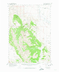
1956 Map of Doublespring
USGS Topo · Published 1959About this map
The Pahsimeroi Mountains dominate this mid-century survey of the high-altitude divide between Custer and Lemhi counties. Reaching heights at Grouse Creek Mtn and McGowan, the range is defined by a series of steep drainages including Christian Gulch and Mulkey Gulch. The Challis National Forest boundary encloses much of this high country, which gives way to the broad valley of the Big Pahsimeroi River to the east. Human presence is concentrated around the Doublespring Ranch and scattered springs, with Jeep Trails providing the primary access through the basins and canyons. The landscape is dotted with descriptive local landmarks such as Sheep Pen Basin, Wino Basin, and Dead Cat Canyon, reflecting a history of livestock ranching and exploration in this high-desert mountain environment.
Find a feature on this map
40 named features on this map. Tap any name to fly to it.
Don’t see what you’re looking for? This feature index may not catch every label — zoom into the map to look around manually.
Map Details
Editions of this 1956 Doublespring Map
2 editions found
Other maps of this area

1929 · Bayhorse
USGS Topo · 1:125,000

1935 · Borah Peak
USGS Topo · 1:125,000

1938 · Borah Peak
USGS Topo · 1:125,000

1955 · Dubois
USGS Topo · 1:250,000

1956 · Patterson
USGS Topo · 1:62,500

1956 · Donkey Hills
USGS Topo · 1:62,500

1956 · May
USGS Topo · 1:62,500

1956 · Challis
USGS Topo · 1:62,500

1957 · Challis
USGS Topo · 1:250,000

1958 · Dubois
USGS Topo · 1:250,000