1956 Map of May
USGS Topo · Published 1959About this map
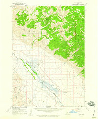
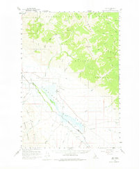
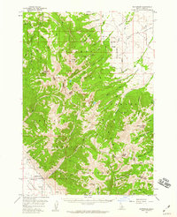
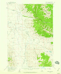
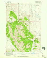
The Pahsimeroi Valley serves as the central focal point of this mid-century survey, framed by the towering heights of the Lemhi Range and the Lost River Mountains. The small settlement of May is situated near the valley floor, featuring a local Cemetery and a dedicated Landing Strip, indicating the reliance on light aircraft for connectivity in this high-altitude ranching region. The Pahsimeroi River meanders northwest through the valley toward the Salmon R, fed by numerous alpine tributaries like Falls Creek and Morse Creek. This landscape is largely defined by the intersection of the Salmon National Forest and Challis National Forest, where steep drainages such as Black Canyon and Dry Gulch descend from peaks like May Mtn and Long Mtn. The map documents a period when the sparse settlement at Ennis and the surrounding drainages remained essential nodes in the remote interior of Lemhi and Custer counties.
Find a feature on this map
41 named features on this map. Tap any name to fly to it.
Don’t see what you’re looking for? This feature index may not catch every label — zoom into the map to look around manually.
Map Details
Editions of this 1956 May Map
2 editions found
Other maps of this area

1929 · Bayhorse
USGS Topo · 1:125,000

1935 · Borah Peak
USGS Topo · 1:125,000

1938 · Borah Peak
USGS Topo · 1:125,000

1955 · Dubois
USGS Topo · 1:250,000
1956 · Patterson
USGS Topo · 1:62,500
1956 · Donkey Hills
USGS Topo · 1:62,500
1956 · Doublespring
USGS Topo · 1:62,500
1956 · Challis
USGS Topo · 1:62,500
1956 · Lemhi
USGS Topo · 1:62,500

1957 · Challis
USGS Topo · 1:250,000