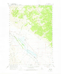
1956 Map of May
USGS Topo · Published 1975About this map
The Pahsimeroi Valley serves as a central corridor for high-altitude ranching and settlement in the mid-1950s, bounded by the towering peaks of the Challis National Forest and Salmon National Forest. The settlement of May sits as a primary hub within the valley, supported by a nearby Landing Strip and a Cemetery, indicating the established nature of this remote mountain community. To the north, the terrain transitions into the steep drainages of the Salmon River, while the southern reaches are dominated by the Lost River Mountains. The map reveals a landscape defined by water rights and access, with numerous named creeks such as Patterson Creek and Morgan Creek feeding the Pahsimeroi River. The presence of bench marks like BM 5022 and BM 5321 near Patterson underscores the detailed survey work required to manage this complex topography of gulches and peaks like May Mtn.
Find a feature on this map
54 named features on this map. Tap any name to fly to it.
Don’t see what you’re looking for? This feature index may not catch every label — zoom into the map to look around manually.
Map Details
Editions of this 1956 May Map
2 editions found
Other maps of this area

1929 · Bayhorse
USGS Topo · 1:125,000

1935 · Borah Peak
USGS Topo · 1:125,000

1938 · Borah Peak
USGS Topo · 1:125,000

1955 · Dubois
USGS Topo · 1:250,000

1956 · Patterson
USGS Topo · 1:62,500

1956 · Donkey Hills
USGS Topo · 1:62,500

1956 · Doublespring
USGS Topo · 1:62,500

1956 · May
USGS Topo · 1:62,500

1956 · Challis
USGS Topo · 1:62,500

1956 · Lemhi
USGS Topo · 1:62,500