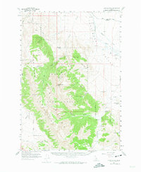
1956 Map of Doublespring
USGS Topo · Published 1974About this map
The Lost River Mountains dominate this mid-century survey, forming a massive high-altitude barrier within the Challis National Forest. The landscape is defined by its dramatic relief, falling away from peaks like Grouse Creek Mtn into deep drainages such as Christian Gulch and Rock Canyon. To the east, the terrain levels out into the Pahsimeroi Valley, where the Pahsimeroi River and Goldburg Creek provide essential water sources for the region's sparse ranching operations.
Find a feature on this map
44 named features on this map. Tap any name to fly to it.
Don’t see what you’re looking for? This feature index may not catch every label — zoom into the map to look around manually.
Map Details
Editions of this 1956 Doublespring Map
2 editions found
Other maps of this area

1929 · Bayhorse
USGS Topo · 1:125,000

1935 · Borah Peak
USGS Topo · 1:125,000

1938 · Borah Peak
USGS Topo · 1:125,000

1955 · Dubois
USGS Topo · 1:250,000

1956 · Patterson
USGS Topo · 1:62,500

1956 · Donkey Hills
USGS Topo · 1:62,500

1956 · Doublespring
USGS Topo · 1:62,500

1956 · May
USGS Topo · 1:62,500

1956 · Challis
USGS Topo · 1:62,500

1957 · Challis
USGS Topo · 1:250,000