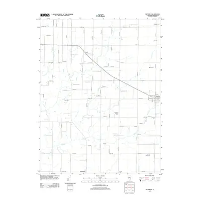
2012 Map of Dieterich
USGS Topo · Published 2012About this map
Dieterich serves as the primary hub of this Effingham County landscape, where the local economy is anchored by established family operations such as Niemerg Dairy Farm, Probst Family Farms, and Schottman Farms. The village itself is organized around a grid including W Section St and Fayette St, with a central Po serving the surrounding rural community. To the south, the settlement of Elliottstown sits near the banks of Little Bishop Cr, marking a long-standing point of habitation in the region.
Find a feature on this map
80 named features on this map. Tap any name to fly to it.
Don’t see what you’re looking for? This feature index may not catch every label — zoom into the map to look around manually.
Map Details
Editions of this 2012 Dieterich Map
This is the sole edition of this map. No revisions or reprints were ever made.
Other maps of this area

1950 · Effingham
USGS Topo · 1:62,500

1951 · Effingham
USGS Topo · 1:62,500

1953 · Teutopolis
USGS Topo · 1:62,500

1953 · Sailor Springs
USGS Topo · 1:62,500

1956 · Edgewood
USGS Topo · 1:62,500

1958 · Decatur
USGS Topo · 1:250,000

1958 · Belleville
USGS Topo · 1:250,000

1961 · Decatur
USGS Topo · 1:250,000

1962 · Belleville
USGS Topo · 1:250,000
1985 · Latona
USGS Topo · 1:24,000