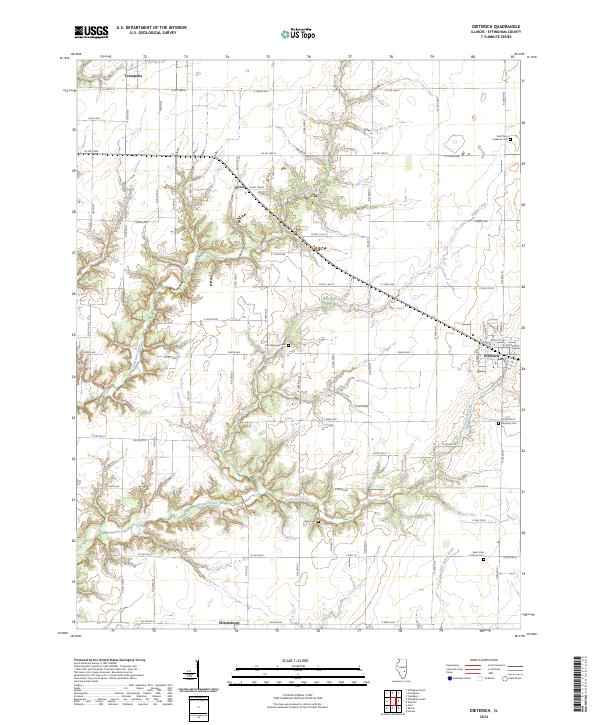
2024 Map of Dieterich
USGS Topo · Published 2024About this map
Dieterich and the surrounding agricultural landscape of Effingham County are defined by a grid of rural routes and the winding paths of local waterways. The village center, located at the junction of W Center St and E Center St, serves as a hub for the neighboring settlements of Evers, Teutopolis, and Elliottstown. This modern survey illustrates how long-established landmarks continue to anchor the region, particularly its religious and burial sites. Genealogy researchers can find precisely mapped locations for Saint John Lutheran Cem, Saint Paul Lutheran Cem, and Saint Aloysius Cem. The terrain is characterized by the branching drainages of Bishop Creek, Dieterich Creek, and Little Salt Creek, which break the regular township road grid and create a varied landscape of woodlots and fields in this section of the Illinois prairie.
Find a feature on this map
49 named features on this map. Tap any name to fly to it.
Don’t see what you’re looking for? This feature index may not catch every label — zoom into the map to look around manually.
Map Details
Editions of this 2024 Dieterich Map
This is the sole edition of this map. No revisions or reprints were ever made.
Other maps of this area

1950 · Effingham
USGS Topo · 1:62,500

1951 · Effingham
USGS Topo · 1:62,500

1953 · Teutopolis
USGS Topo · 1:62,500

1953 · Sailor Springs
USGS Topo · 1:62,500

1956 · Edgewood
USGS Topo · 1:62,500

1958 · Decatur
USGS Topo · 1:250,000

1958 · Belleville
USGS Topo · 1:250,000

1961 · Decatur
USGS Topo · 1:250,000

1962 · Belleville
USGS Topo · 1:250,000
1985 · Latona
USGS Topo · 1:24,000