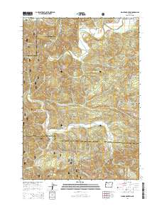
2014 Map of Digger Mountain
USGS Topo · Published 2014About this map
Alsea Valley sits at the northern edge of this study, where the Alsea River meanders near its junction with Burch Cr and Maltby Cr. This 2014 survey documents a landscape defined by the intersection of the Siuslaw National Forest and private timberlands across the borders of Lincoln, Benton, and Lane counties. The terrain is dominated by prominent elevations such as Digger Mountain and Taylor Butte, which rise between the drainages of Salmonberry Cr and Lobster Cr. Genealogists and local historians will find the Lone Fir Cem situated near the headwaters of Little Lobster Cr, a solitary landmark in the forested hills. The map captures the complex network of forest roads, such as Van Horn Rd and Salmonberry Rd, that serve small rural pockets like Missouri Bend and Lobster Valley.
Find a feature on this map
49 named features on this map. Tap any name to fly to it.
Don’t see what you’re looking for? This feature index may not catch every label — zoom into the map to look around manually.
Map Details
Editions of this 2014 Digger Mountain Map
This is the sole edition of this map. No revisions or reprints were ever made.
Other maps of this area

1918 · Mapleton
USGS Topo · 1:48,000

1940 · Mapleton
USGS Topo · 1:62,500

1941 · Blachly
USGS Topo · 1:62,500

1942 · Alsea
USGS Topo · 1:62,500

1942 · Blachly
USGS Topo · 1:62,500

1942 · Tidewater
USGS Topo · 1:62,500

1945 · Mapleton
USGS Topo · 1:62,500

1953 · Salem
USGS Topo · 1:250,000

1954 · Salem
USGS Topo · 1:250,000

1956 · Alsea
USGS Topo · 1:62,500