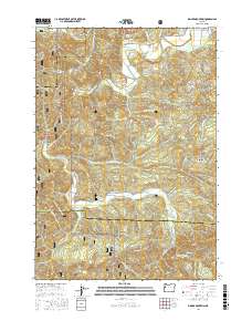
2017 Map of Digger Mountain
USGS Topo · Published 2017About this map
Lone Fir Cem sits as a quiet landmark within the drainage of Lobster Cr, part of a landscape defined by the intersection of Benton, Lane, and Lincoln counties. The area is characterized by high ridges and deep creek valleys, featuring peaks like Digger Mtn and Little Lobster Summit. The Alsea River winds through the northern reach of the quadrangle, creating notable landforms such as Missouri Bend and the broader Alsea Valley.
Find a feature on this map
65 named features on this map. Tap any name to fly to it.
Don’t see what you’re looking for? This feature index may not catch every label — zoom into the map to look around manually.
Map Details
Editions of this 2017 Digger Mountain Map
This is the sole edition of this map. No revisions or reprints were ever made.
Other maps of this area

1918 · Mapleton
USGS Topo · 1:48,000

1940 · Mapleton
USGS Topo · 1:62,500

1941 · Blachly
USGS Topo · 1:62,500

1942 · Alsea
USGS Topo · 1:62,500

1942 · Blachly
USGS Topo · 1:62,500

1942 · Tidewater
USGS Topo · 1:62,500

1945 · Mapleton
USGS Topo · 1:62,500

1953 · Salem
USGS Topo · 1:250,000

1954 · Salem
USGS Topo · 1:250,000

1956 · Alsea
USGS Topo · 1:62,500