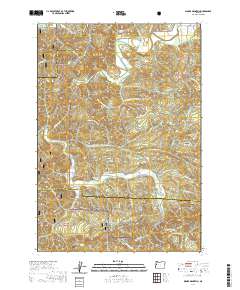
2020 Map of Digger Mountain
USGS Topo · Published 2020About this map
Alsea Valley and the surrounding drainage basins of the Alsea River define this region along the border of Lane, Benton, and Lincoln Counties. The landscape is characterized by a dense network of watercourses, including Lobster Cr and its tributaries which carve through the south, while Salmonberry Cr flows toward the center. Small settlements and points of interest such as Missouri Bend and Lobster Valley are connected by a system of logging and forest service roads that penetrate the Siuslaw National Forest.
Find a feature on this map
66 named features on this map. Tap any name to fly to it.
Don’t see what you’re looking for? This feature index may not catch every label — zoom into the map to look around manually.
Map Details
Editions of this 2020 Digger Mountain Map
This is the sole edition of this map. No revisions or reprints were ever made.
Other maps of this area

1918 · Mapleton
USGS Topo · 1:48,000

1940 · Mapleton
USGS Topo · 1:62,500

1941 · Blachly
USGS Topo · 1:62,500

1942 · Alsea
USGS Topo · 1:62,500

1942 · Blachly
USGS Topo · 1:62,500

1942 · Tidewater
USGS Topo · 1:62,500

1945 · Mapleton
USGS Topo · 1:62,500

1953 · Salem
USGS Topo · 1:250,000

1954 · Salem
USGS Topo · 1:250,000

1956 · Alsea
USGS Topo · 1:62,500