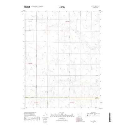
2018 Map of Dighton SE
USGS Topo · Published 2018About this map
The rolling plains of western Kansas are defined by seasonal drainage patterns and a geometric grid of county roads in this survey of the Dighton SE quadrangle. The northern landscape is carved by the ephemeral Spring Cr, while the southern reaches are marked by the winding path of Hackberry Cr. The topography reveals the transition across the Lane Co Finney Co line, where the high prairie begins to dip toward these creek beds. Of particular interest for genealogists and local historians is the isolated Thomas Cem located in the northeast, a quiet landmark amidst the vast section lines. The road network, with uniquely named routes such as Turkey Red and Quantum, illustrates the systematic organization of the land into townships like t20s r27w.
Find a feature on this map
27 named features on this map. Tap any name to fly to it.
Don’t see what you’re looking for? This feature index may not catch every label — zoom into the map to look around manually.
Map Details
Editions of this 2018 Dighton SE Map
This is the sole edition of this map. No revisions or reprints were ever made.
Other maps of this area

1955 · Scott City
USGS Topo · 1:250,000

1958 · Scott City
USGS Topo · 1:250,000

1965 · Beeler
USGS Topo · 1:24,000

1974 · Ravanna
USGS Topo · 1:24,000

1974 · Dighton SW
USGS Topo · 1:24,000

1974 · Dighton
USGS Topo · 1:24,000

1974 · Alamota
USGS Topo · 1:24,000

1974 · Hay Canyon
USGS Topo · 1:24,000

1974 · Beeler SW
USGS Topo · 1:24,000

1974 · Dighton SE
USGS Topo · 1:24,000