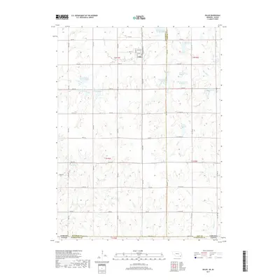
2017 Map of Diller
USGS Topo · Published 2017About this map
Diller serves as the central hub of this agricultural landscape in Jefferson County, where the street grid of Commercial St and Girrard St gives way to a sprawling network of section roads and water management systems. The terrain is defined by a sophisticated series of reservoirs along the Big Indian Cr drainage system, including Big Indian Cr Reservoir 7-1-A and Big Indian Creek Reservoir 8-E. These water bodies are vital to the local farming economy, reflecting the systematic land use that characterizes the Nebraska-Kansas border region.
Find a feature on this map
56 named features on this map. Tap any name to fly to it.
Don’t see what you’re looking for? This feature index may not catch every label — zoom into the map to look around manually.
Map Details
Editions of this 2017 Diller Map
This is the sole edition of this map. No revisions or reprints were ever made.
Other maps of this area

1889 · Marysville
USGS Topo · 1:125,000

1893 · Washington
USGS Topo · 1:125,000

1894 · Marysville
USGS Topo · 1:125,000

1955 · Manhattan
USGS Topo · 1:250,000

1955 · Lincoln
USGS Topo · 1:250,000

1956 · Manhattan
USGS Topo · 1:250,000

1957 · Manhattan
USGS Topo · 1:250,000

1957 · Lincoln
USGS Topo · 1:250,000

1958 · Lincoln
USGS Topo · 1:250,000
1966 · Washington NE
USGS Topo · 1:24,000