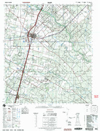
2002 Map of Dilley
USGS Topo · Published 2002About this map
Dilley serves as the primary hub of this South Texas landscape, situated along the corridor of the Union Pacific Railroad. The map details the transition from the town's residential core to the surrounding agricultural and industrial lands, featuring the Briscoe State Prison and the Dilley Airpark on its northern outskirts. Tracing southward into LaSalle County, the rural settlements of Millett and Gardendale appear along the rail line and Highway 35. The terrain is defined by the drainage networks of the Frio River, Cibolo Creek, and Slaughter Creek, which cut through a landscape dotted with commercial Gravel pits and the sprawling Burns Ranch. Genealogists will find value in the specific locations of the Dilley Cemetery, Millett Cemetery, and Migo Cemetery, which provide fixed points of reference for local family histories.
Find a feature on this map
25 named features on this map. Tap any name to fly to it.
Don’t see what you’re looking for? This feature index may not catch every label — zoom into the map to look around manually.
Map Details
Editions of this 2002 Dilley Map
This is the sole edition of this map. No revisions or reprints were ever made.
Other maps of this area

1925 · Pearsall 1-c
USGS Topo · 1:48,000

1927 · Pearsall
USGS Topo · 1:62,500

1927 · Bart
USGS Topo · 1:62,500

1929 · Cotulla
USGS Topo · 1:125,000

1934 · Schattel
USGS Topo · 1:62,500

1940 · Cotulla
USGS Topo · 1:62,500

1940 · Artesia Wells
USGS Topo · 1:62,500

1942 · Divot
USGS Topo · 1:62,500

1942 · Fowlerton
USGS Topo · 1:62,500

1942 · Dilley
USGS Topo · 1:62,500