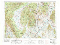
1955 Map of Dillon
USGS Topo · Published 1978About this map
Dillon serves as a central hub in this high-altitude landscape where the Continental Divide dictates the flow of major western waterways. The map captures the complex drainage systems of the Jefferson River, Big Hole River, and Beaverhead River before the full impact of modern interstate expansion. To the north and west, the Pintlar Wilderness and Beaverhead National Forest dominate the terrain, preserving a mid-century view of the Montana-Idaho border region. Local industry and transit are defined by the paths of the Burlington Northern and Milwaukee Road railroads, which connected valley settlements like Twin Bridges and Sheridan to larger markets. The placement of the Clark Canyon Reservoir and Ruby River Reservoir highlights the era's focus on water management for the surrounding basins, including the Sweetwater Basin and Big Hole Divide.
Find a feature on this map
164 named features on this map. Tap any name to fly to it.
Don’t see what you’re looking for? This feature index may not catch every label — zoom into the map to look around manually.
Map Details
Editions of this 1955 Dillon Map
2 editions found

Other maps of this area

1886 · Fort Logan
USGS Topo · 1:250,000

1888 · Three Forks
USGS Topo · 1:250,000

1889 · Helena
USGS Topo · 1:250,000

1893 · Helena
USGS Topo · 1:250,000

1893 · Dillon
USGS Topo · 1:250,000

1894 · Three Forks
USGS Topo · 1:250,000

1895 · Three Forks
USGS Topo · 1:250,000

1899 · Boulder
USGS Topo · 1:125,000

1899 · Helena
USGS Topo · 1:250,000

1901 · Hamilton
USGS Topo · 1:125,000