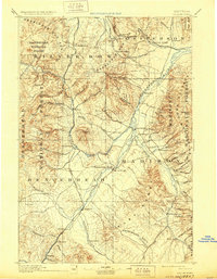
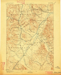
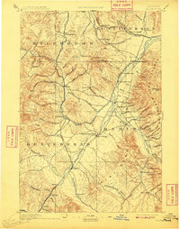
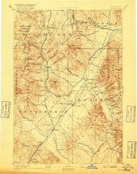
1893 Map of Dillon
USGS Topo · Published 1929About this map
The Dillon area serves as a primary hub for this late nineteenth-century reconnaissance of Southwest Montana, where the Beaverhead River and Oregon Short Line railroad dictate the corridor of travel. The map captures a landscape defined by its mining and ranching economy, from the established streets of the county seat to isolated outposts like Glendale and Rochester. The Continental Divide zigzags across the northern reaches, separating the waters that flow toward the Wise River from those feeding the Jefferson River.
Find a feature on this map
93 named features on this map. Tap any name to fly to it.
Don’t see what you’re looking for? This feature index may not catch every label — zoom into the map to look around manually.
Map Details
Editions of this 1893 Dillon Map
5 editions found
Other maps of this area

1886 · Fort Logan
USGS Topo · 1:250,000

1888 · Three Forks
USGS Topo · 1:250,000

1889 · Helena
USGS Topo · 1:250,000

1893 · Helena
USGS Topo · 1:250,000

1893 · Dillon
USGS Topo · 1:250,000

1894 · Three Forks
USGS Topo · 1:250,000

1895 · Three Forks
USGS Topo · 1:250,000

1899 · Boulder
USGS Topo · 1:125,000

1899 · Helena
USGS Topo · 1:250,000

1903 · Helena
USGS Topo · 1:250,000