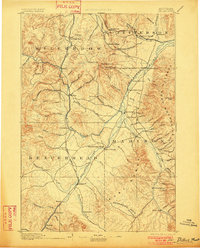
1893 Map of Dillon
USGS Topo · Published 1901About this map
Dillon serves as a primary hub in this late nineteenth-century reconnaissance, situated where the Oregon Short Line railroad follows the winding path of the Beaverhead River. The map illustrates a high-altitude landscape defined by the Continental Divide and the massive Tobacco Root Mountains, where early settlement is dictated by water and mineral wealth. Narrow canyons and high basins are dotted with mining-era outposts like Glendale, Hecla, and Argenta, while the agricultural potential of the valleys is signaled by settlements like Twin Bridges and Sheridan at the confluence of the Big Hole River and Jefferson River. Noteworthy landmarks such as Beaverhead Rock and Point of Rocks provide clear navigational markers for travelers along the river corridors. In the north, the Northern Pacific railroad cuts through Pipestone Pass, connecting the high country near Homestake to the emerging junction at Whitehall.
Find a feature on this map
96 named features on this map. Tap any name to fly to it.
Don’t see what you’re looking for? This feature index may not catch every label — zoom into the map to look around manually.
Map Details
Editions of this 1893 Dillon Map
5 editions found
Other maps of this area

1886 · Fort Logan
USGS Topo · 1:250,000

1888 · Three Forks
USGS Topo · 1:250,000

1889 · Helena
USGS Topo · 1:250,000

1893 · Helena
USGS Topo · 1:250,000

1893 · Dillon
USGS Topo · 1:250,000

1894 · Three Forks
USGS Topo · 1:250,000

1895 · Three Forks
USGS Topo · 1:250,000

1899 · Boulder
USGS Topo · 1:125,000

1899 · Helena
USGS Topo · 1:250,000

1903 · Helena
USGS Topo · 1:250,000