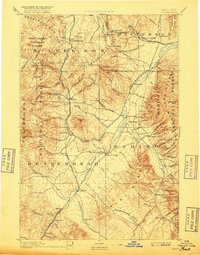
1893 Map of Dillon
USGS Topo · Published 1917About this map
Dillon serves as the focal point of this late 19th-century landscape, a vital hub where the Oregon Short Line follows the path of the Beaverhead River. The map reveals a region defined by its early mining and ranching economy, with mining camps and settlements like Glendale, Rochester, and Silver Star dotting the foothills of the Highland Mts and Ruby Range. This era of Western development is captured before the consolidation of modern highways, showing a network of mountain passes like Deer Lodge Pass and essential crossings such as Parsons Bridge.
Find a feature on this map
92 named features on this map. Tap any name to fly to it.
Don’t see what you’re looking for? This feature index may not catch every label — zoom into the map to look around manually.
Map Details
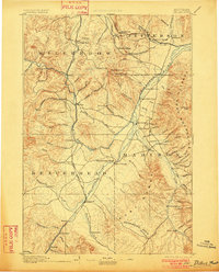
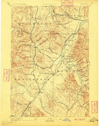
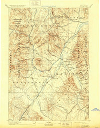
Editions of this 1893 Dillon Map
5 editions found
Other maps of this area

1886 · Fort Logan
USGS Topo · 1:250,000

1888 · Three Forks
USGS Topo · 1:250,000

1889 · Helena
USGS Topo · 1:250,000

1893 · Helena
USGS Topo · 1:250,000

1893 · Dillon
USGS Topo · 1:250,000

1894 · Three Forks
USGS Topo · 1:250,000

1895 · Three Forks
USGS Topo · 1:250,000

1899 · Boulder
USGS Topo · 1:125,000

1899 · Helena
USGS Topo · 1:250,000

1903 · Helena
USGS Topo · 1:250,000