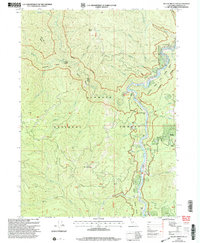
2001 Map of Dillon Mountain
USGS Topo · Published 2004About this map
Klamath River dominates this mountainous portion of the Klamath National Forest, carving a deep corridor through the Siskiyou landscape. The river is marked by numerous river bars and access points, including Rattlesnake Bar, Persido Bar, and the Ti Bar River Access Dispersed Area. Human footprints are concentrated along this waterway and the few rugged roads like Thomas Road, where the Kennedy Homestead and the Cottage Grove (Site) represent early settlement attempts and ranching history.
Find a feature on this map
43 named features on this map. Tap any name to fly to it.
Don’t see what you’re looking for? This feature index may not catch every label — zoom into the map to look around manually.
Map Details
Editions of this 2001 Dillon Mountain Map
2 editions found
Other maps of this area

1914 · Seiad
USGS Topo · 1:125,000

1922 · Preston Peak
USGS Topo · 1:125,000

1922 · Seiad
USGS Topo · 1:125,000

1925 · Hoopa
USGS Topo · 1:125,000

1948 · Weed
USGS Topo · 1:250,000

1950 · Weed
USGS Topo · 1:250,000

1952 · Orleans
USGS Topo · 1:62,500

1955 · Dillon Mtn
USGS Topo · 1:62,500

1955 · Ukonom Lake
USGS Topo · 1:62,500

1955 · Forks of Salmon
USGS Topo · 1:62,500