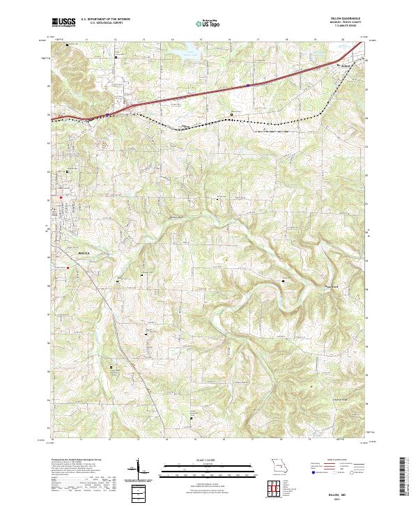
2021 Map of Dillon
USGS Topo · Published 2021About this map
The Bourbeuse River headwaters and the rolling terrain of the Ozark Highlands characterize this landscape between the growing centers of Rolla and St. James. This era of development is defined by the legacy of Route 66, appearing here as Old Hwy 66 and HWY 66, paralleling the critical BNSF Railway corridor. Numerous small family and community burial grounds, including the Thomas - Fairview Cem, Dewing Cem, and the Old Dean Cem, are scattered across the hills, offering essential touchpoints for genealogical research in Phelps County. The map also captures the educational footprint of East Central College and the agricultural pocket of Dillon. Further south, the landscape transitions toward the drainage of the Dry Fork and Little Dry Fork, where the prominent Panther Bluff stands above the creek valleys, and the small settlement of Dean Ford marks a rural crossroads.
Find a feature on this map
146 named features on this map. Tap any name to fly to it.
Don’t see what you’re looking for? This feature index may not catch every label — zoom into the map to look around manually.
Map Details
Editions of this 2021 Dillon Map
This is the sole edition of this map. No revisions or reprints were ever made.
Other maps of this area

1912 · Rolla
USGS Topo · 1:62,500

1928 · Meramec Spring
USGS Topo · 1:62,500

1934 · Redbird
USGS Topo · 1:62,500

1937 · Vienna
USGS Topo · 1:62,500

1938 · Redbird
USGS Topo · 1:62,500

1938 · Vienna
USGS Topo · 1:48,000

1949 · Saint Louis
USGS Topo · 1:250,000

1949 · Vienna
USGS Topo · 1:62,500

1949 · Rolla
USGS Topo · 1:250,000

1949 · Meramec Spring
USGS Topo · 1:62,500