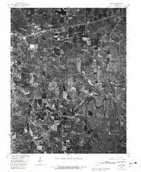
1980 Map of Dillon
USGS Topo · Published 1981About this map
St James and Rolla anchor this 1980 orthophotomap of eastern Phelps County, where the transition from municipal centers to rural Ozark landscapes is clearly visible through aerial photography. The settlement of Dillon sits along a major transportation corridor that cuts across the northern half of the sheet, while the surrounding countryside is defined by the winding course of the Bourbeuse R and the Dry Fork. The presence of the USGS Center reflects the area's long-standing connection to the geological sciences and mapping industry.
Find a feature on this map
11 named features on this map. Tap any name to fly to it.
Don’t see what you’re looking for? This feature index may not catch every label — zoom into the map to look around manually.
Map Details
Editions of this 1980 Dillon Map
This is the sole edition of this map. No revisions or reprints were ever made.
Other maps of this area

1912 · Rolla
USGS Topo · 1:62,500

1928 · Meramec Spring
USGS Topo · 1:62,500

1934 · Redbird
USGS Topo · 1:62,500

1937 · Vienna
USGS Topo · 1:62,500

1938 · Redbird
USGS Topo · 1:62,500

1938 · Vienna
USGS Topo · 1:48,000

1949 · Saint Louis
USGS Topo · 1:250,000

1949 · Vienna
USGS Topo · 1:62,500

1949 · Rolla
USGS Topo · 1:250,000

1949 · Meramec Spring
USGS Topo · 1:62,500