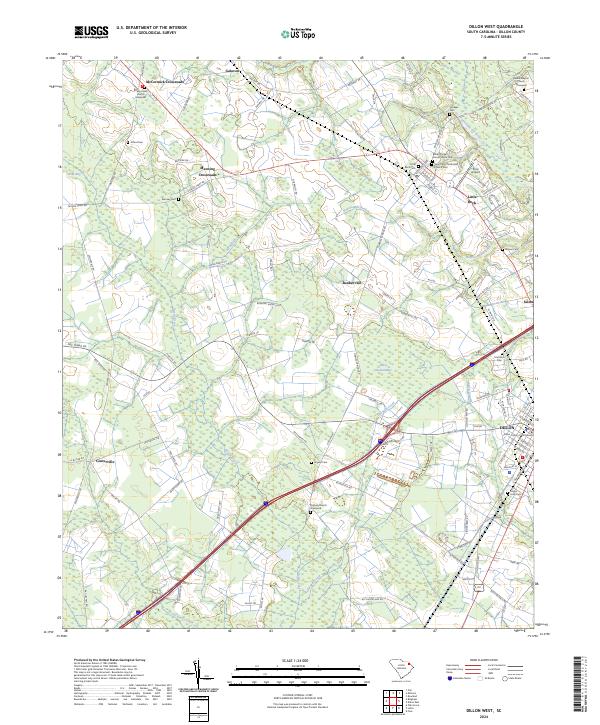
2024 Map of Dillon West
USGS Topo · Published 2024About this map
Dillon and its surrounding rural landscapes are meticulously detailed in this recent survey, centered on the Dillon County Courthouse and the town’s established residential core. The terrain is defined by the slow-moving waters of the Little Pee Dee River and its various tributaries such as Maple Swamp and Reedy Creek. This coastal plain environment is dotted with small, long-standing communities and intersection hamlets like Little Rock, McCormick Crossroads, and Bunker Hill.
Find a feature on this map
118 named features on this map. Tap any name to fly to it.
Don’t see what you’re looking for? This feature index may not catch every label — zoom into the map to look around manually.
Map Details
Editions of this 2024 Dillon West Map
This is the sole edition of this map. No revisions or reprints were ever made.
Other maps of this area

1942 · Rockingham
USGS Topo · 1:125,000

1943 · Gum Swamp
USGS Topo · 1:62,500

1953 · Florence
USGS Topo · 1:250,000

1954 · Florence
USGS Topo · 1:250,000

1959 · Fork
USGS Topo · 1:24,000

1960 · Latta
USGS Topo · 1:24,000

1960 · Dillon East
USGS Topo · 1:24,000

1960 · Dillon West
USGS Topo · 1:24,000

1971 · Minturn
USGS Topo · 1:24,000

1972 · Clio
USGS Topo · 1:24,000