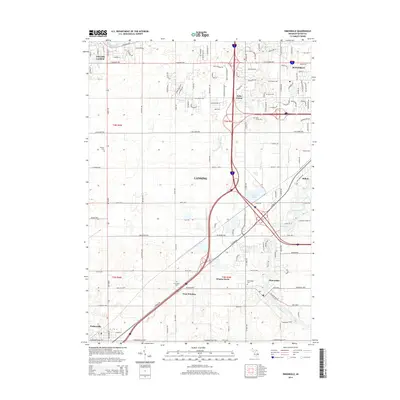
2014 Map of Dimondale
USGS Topo · Published 2014About this map
The Grand River and its numerous tributaries, including Carrier Cr and Whaley Drain, carve a path through this developed region on the outskirts of Lansing. This era shows a complex suburban and industrial landscape where modern transit corridors intersect with the older agrarian foundations of Eaton and Ingham counties. Evidence of the area's long-settled history is found in numerous local burial grounds, such as Delta Center Cem near Delta Center and the Pray Cem to the south.
Find a feature on this map
135 named features on this map. Tap any name to fly to it.
Don’t see what you’re looking for? This feature index may not catch every label — zoom into the map to look around manually.
Map Details
Editions of this 2014 Dimondale Map
This is the sole edition of this map. No revisions or reprints were ever made.
Other maps of this area

1910 · Lansing
USGS Topo · 1:62,500

1912 · Lansing
USGS Topo · 1:62,500

1927 · De Witt
USGS Topo · 1:62,500

1945 · Portland
USGS Topo · 1:62,500

1949 · Charlotte
USGS Topo · 1:62,500

1958 · Grand Rapids
USGS Topo · 1:250,000

1961 · Grand Rapids
USGS Topo · 1:250,000

1962 · Grand Rapids
USGS Topo · 1:250,000
1965 · Lansing South
USGS Topo · 1:24,000
1965 · Wacousta
USGS Topo · 1:24,000