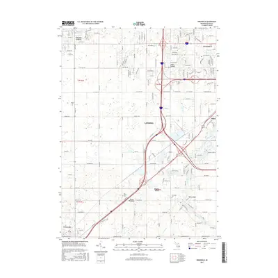
2017 Map of Dimondale
USGS Topo · Published 2017About this map
The Grand River winds through the southeastern portion of this landscape, providing a geographic anchor for the town of Dimondale. This area of Ingham and Eaton counties shows a transition from the established suburban development of Lansing and Waverly in the northeast to the more dispersed agricultural settlements of West Windsor and Potterville in the southwest. A network of historical burial grounds, including the Pioneer Cemetery and West Windsor Cemetery, are preserved among the modern transit corridors. The mapping of regional water management is evident through named features like Whaley Drain and Holly Drain, which illustrate the modification of the local hydrology to support the growth of communities like Millett and Delta Center. Local infrastructure follows long-established routes, with Lansing Road and Davis Highway connecting these outlying townships to the urban core.
Find a feature on this map
135 named features on this map. Tap any name to fly to it.
Don’t see what you’re looking for? This feature index may not catch every label — zoom into the map to look around manually.
Map Details
Editions of this 2017 Dimondale Map
This is the sole edition of this map. No revisions or reprints were ever made.
Other maps of this area

1910 · Lansing
USGS Topo · 1:62,500

1912 · Lansing
USGS Topo · 1:62,500

1927 · De Witt
USGS Topo · 1:62,500

1945 · Portland
USGS Topo · 1:62,500

1949 · Charlotte
USGS Topo · 1:62,500

1958 · Grand Rapids
USGS Topo · 1:250,000

1961 · Grand Rapids
USGS Topo · 1:250,000

1962 · Grand Rapids
USGS Topo · 1:250,000
1965 · Lansing South
USGS Topo · 1:24,000
1965 · Wacousta
USGS Topo · 1:24,000