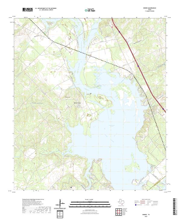
2022 Map of Dinero
USGS Topo · Published 2022About this map
Lake Corpus Christi dominates the central landscape of this Live Oak County region, where the winding inlets of Ramirena Cr and Paisano Cr meet the reservoir. The small settlement of Mount Lucas sits near the water's edge, surrounded by a series of family-named topographic features such as Balania Hill and Rufe Williams Hollow. These names reflect the deep agricultural and ranching roots of the area. For genealogists and local historians, several small burial grounds are documented near the shoreline, including Wright Cem, Balania Cem, and Lagarto Cem. The terrain is defined by its drainage patterns into the lake, evidenced by numerous named draws like Mustang Hollow, Hog Hollow, and Weathersby Hollow. The boundary between Live Oak Co and San Patricio Co crosses the water in the southeastern corner, marking the divide between these two coastal plain counties.
Find a feature on this map
67 named features on this map. Tap any name to fly to it.
Don’t see what you’re looking for? This feature index may not catch every label — zoom into the map to look around manually.
Map Details
Editions of this 2022 Dinero Map
This is the sole edition of this map. No revisions or reprints were ever made.
Other maps of this area

1920 · Mikeska
USGS Topo · 1:125,000

1925 · Oakville No. 4
USGS Topo · 1:48,000

1925 · Mathis No. 2
USGS Topo · 1:48,000

1925 · Mathis No. 3
USGS Topo · 1:48,000

1927 · Mathis
USGS Topo · 1:62,500

1927 · Oakville
USGS Topo · 1:62,500

1953 · Crystal City
USGS Topo · 1:250,000

1953 · Beeville
USGS Topo · 1:250,000

1954 · Fleming
USGS Topo · 1:62,500

1954 · Mathis
USGS Topo · 1:62,500
Featured Places
- Lake Mathis Point Colonia, TX
- Lakeshore Gardens, TX
- Peace Valley Harbor, TX
- Hideaway Hill, TX
- Los Lomas, TX