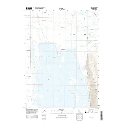
2013 Map of Dingle
USGS Topo · Published 2013About this map
Bear Lake Valley serves as a critical agricultural and hydrological corridor in this 2013 Idaho survey. The landscape is defined by an intricate network of water management features, including the Rainbow Canal, Black Otter Canal, and Ream Crockett Canal, which divert water throughout the basin. These engineering works support the area near Dingle, where the Bear River winds through the northern reaches. To the east, the terrain rises sharply from the valley floor toward Merkley Mtn and Lake Ridge, creating a distinct vertical boundary between the wetlands and the uplands.
Find a feature on this map
39 named features on this map. Tap any name to fly to it.
Don’t see what you’re looking for? This feature index may not catch every label — zoom into the map to look around manually.
Map Details
Editions of this 2013 Dingle Map
This is the sole edition of this map. No revisions or reprints were ever made.
Other maps of this area

1909 · Montpelier
USGS Topo · 1:125,000

1911 · Montpelier
USGS Topo · 1:125,000

1955 · Preston
USGS Topo · 1:250,000

1958 · Preston
USGS Topo · 1:250,000

1962 · Preston
USGS Topo · 1:250,000

1967 · Montpelier
USGS Topo · 1:24,000

1967 · Paris
USGS Topo · 1:24,000

1967 · Ovid
USGS Topo · 1:24,000

1967 · Dingle
USGS Topo · 1:24,000
1969 · St Charles
USGS Topo · 1:24,000