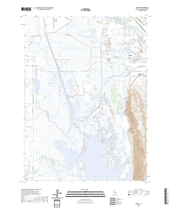
2023 Map of Dingle
USGS Topo · Published 2023About this map
Dingle sits at the edge of the wetlands where the Bear River and Bear Lake Outlet dominate the valley floor. This 2023 survey illustrates a landscape defined by water management and conservation, with much of the terrain preserved within the Bear Lake National Wildlife Refuge. A complex network of irrigation and drainage infrastructure, including the Rainbow Canal, Peg Leg Ditch, and Ream Crockett Canal, crisscrosses the lowlands between Dingle Swamp and Mud Lake. To the east, the topography shifts abruptly as the valley meets the steep slopes of Lake Ridge and Merkley Mtn. Local landmarks like the Bear Lake County Airport and the Dingle Cem provide anchor points for family historians and residents in this rural corner of Idaho, where the legacy of early 20th-century water engineering remains a central feature of the modern environment.
Find a feature on this map
42 named features on this map. Tap any name to fly to it.
Don’t see what you’re looking for? This feature index may not catch every label — zoom into the map to look around manually.
Map Details
Editions of this 2023 Dingle Map
This is the sole edition of this map. No revisions or reprints were ever made.
Other maps of this area

1909 · Montpelier
USGS Topo · 1:125,000

1911 · Montpelier
USGS Topo · 1:125,000

1955 · Preston
USGS Topo · 1:250,000

1958 · Preston
USGS Topo · 1:250,000

1962 · Preston
USGS Topo · 1:250,000

1967 · Montpelier
USGS Topo · 1:24,000

1967 · Paris
USGS Topo · 1:24,000

1967 · Ovid
USGS Topo · 1:24,000

1967 · Dingle
USGS Topo · 1:24,000
1969 · St Charles
USGS Topo · 1:24,000