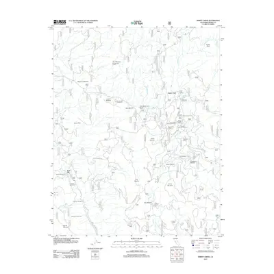
2012 Map of Dinkey Creek
USGS Topo · Published 2012About this map
Dinkey Creek serves as the central focal point of this high-altitude landscape in Fresno County, where a dense network of forest service roads and specialized mountain camps defines the land use. The map illustrates a recreational and forestry-driven economy, evidenced by a concentration of group sites like Camp Mary-Y-Mac, Camp El-O-Win, and Camp Fresno situated near the water. Higher elevations are marked by functional landmarks such as the Bald Mountain Lookout and the Glen Meadow Forest Service Facility. Local industry and heritage are visible at Bretz Mill and the nearby Sawmill Campground, pointing to the area's history of timber management. The terrain is characterized by a series of named meadows and peaks, including Strawberry Meadow, Dinkey Dome, and Dinkey Mountain, which organize the drainage patterns of tributaries like Exchequer Cr and Providence Cr.
Find a feature on this map
140 named features on this map. Tap any name to fly to it.
Don’t see what you’re looking for? This feature index may not catch every label — zoom into the map to look around manually.
Map Details
Editions of this 2012 Dinkey Creek Map
This is the sole edition of this map. No revisions or reprints were ever made.
Other maps of this area

1904 · Kaiser
USGS Topo · 1:125,000

1922 · Trimmer
USGS Topo · 1:96,000

1924 · Dinuba
USGS Topo · 1:125,000

1942 · Watts Valley
USGS Topo · 1:62,500

1944 · Watts Valley
USGS Topo · 1:62,500

1947 · Mariposa
USGS Topo · 1:250,000

1948 · Fresno
USGS Topo · 1:250,000

1948 · Mariposa
USGS Topo · 1:250,000

1952 · Patterson Mountain
USGS Topo · 1:62,500

1953 · Huntington Lake
USGS Topo · 1:62,500