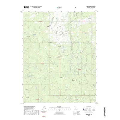
2018 Map of Dinkey Creek
USGS Topo · Published 2018About this map
Sierra Nevada and the surrounding high-altitude terrain of the Sierra National Forest are documented in this 2018 survey, which highlights the area's transition between timbered slopes and clear meadows. The settlement of Dinkey Creek serves as a central hub, surrounded by a landscape defined by names like Dinkey Dome and Dinkey Mtn. To the west, the topographic detail captures the site of Bretz Mill and the community at Pine Ridge.
Find a feature on this map
106 named features on this map. Tap any name to fly to it.
Don’t see what you’re looking for? This feature index may not catch every label — zoom into the map to look around manually.
Map Details
Editions of this 2018 Dinkey Creek Map
This is the sole edition of this map. No revisions or reprints were ever made.
Other maps of this area

1904 · Kaiser
USGS Topo · 1:125,000

1922 · Trimmer
USGS Topo · 1:96,000

1924 · Dinuba
USGS Topo · 1:125,000

1942 · Watts Valley
USGS Topo · 1:62,500

1944 · Watts Valley
USGS Topo · 1:62,500

1947 · Mariposa
USGS Topo · 1:250,000

1948 · Fresno
USGS Topo · 1:250,000

1948 · Mariposa
USGS Topo · 1:250,000

1952 · Patterson Mountain
USGS Topo · 1:62,500

1953 · Huntington Lake
USGS Topo · 1:62,500