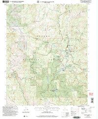
2004 Map of Dinkey Creek
USGS Topo · Published 2007About this map
The Sierra National Forest surrounds a landscape of seasonal camps and timber-related history in this early 21st-century survey. Central to the area is the settlement at Dinkey Creek, which serves as a hub for recreational sites like Camp Fresno and Camp El-O-Win. The map preserves the location of the Bretz Mill (Site), a nod to the region's industrial past, while current operations are represented by the Glen Meadow Work Center and the Dinkey Creek Information Center.
Find a feature on this map
54 named features on this map. Tap any name to fly to it.
Don’t see what you’re looking for? This feature index may not catch every label — zoom into the map to look around manually.
Map Details
Editions of this 2004 Dinkey Creek Map
This is the sole edition of this map. No revisions or reprints were ever made.
Other maps of this area

1904 · Kaiser
USGS Topo · 1:125,000

1922 · Trimmer
USGS Topo · 1:96,000

1924 · Dinuba
USGS Topo · 1:125,000

1942 · Watts Valley
USGS Topo · 1:62,500

1944 · Watts Valley
USGS Topo · 1:62,500

1947 · Mariposa
USGS Topo · 1:250,000

1948 · Fresno
USGS Topo · 1:250,000

1948 · Mariposa
USGS Topo · 1:250,000

1952 · Patterson Mountain
USGS Topo · 1:62,500

1953 · Huntington Lake
USGS Topo · 1:62,500